The CarFree Maine deck is a conceptual proposal for a digital platform that bridges the gap between urban transit users in Boston and tourism destinations in Maine. By targeting the 92,000 car-free residents in Boston and the 500,000 annual Amtrak Downeaster riders, the company aims to build a 'social transportation' network. The deck relies heavily on the integration of existing technologies—such as GPS navigation, collaborative mapping, and gamification elements like Foursquare-style badges—to encourage car-free exploration. While the deck identifies a clear target audience and a specific g…
Key takeaways
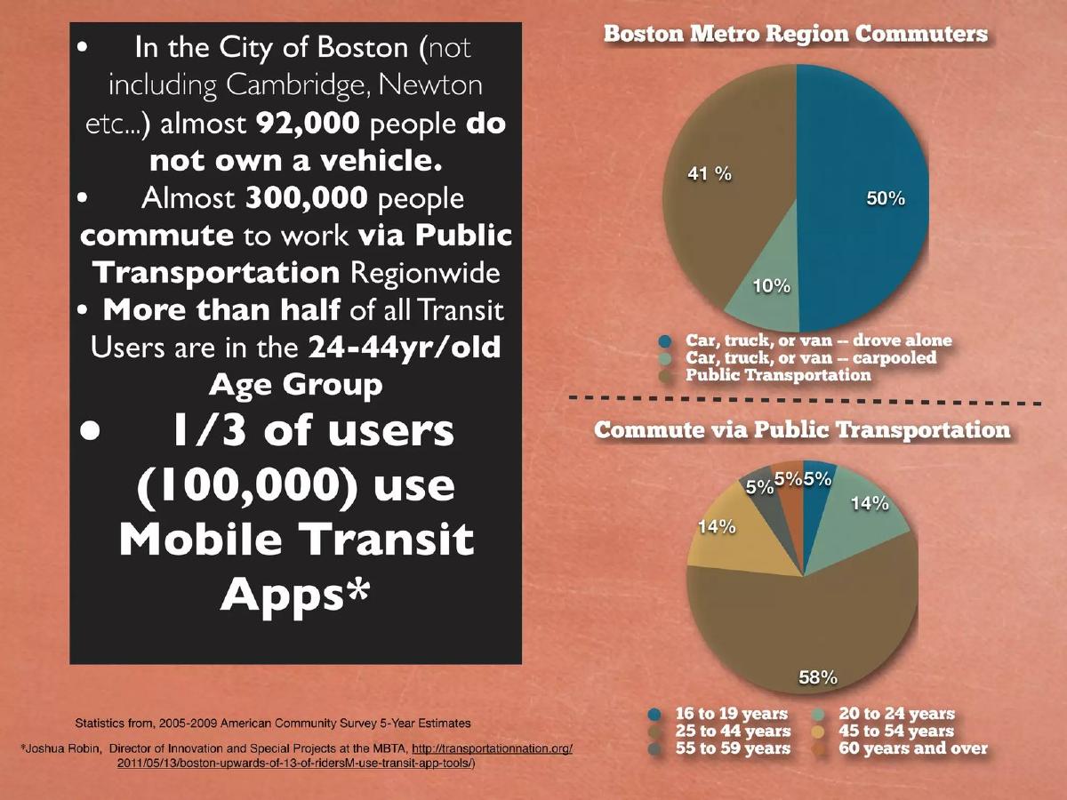
- The deck identifies a target market of 92,000 people in Boston who do not own a vehicle (Slide 2).
- Over 50% of public transit users in the Boston region fall within the 24-44 year old age group (Slide 2).
- The Amtrak Downeaster serves nearly 500,000 riders annually between Boston and Portland (Slide 7).
- The proposed solution involves a web page for planning and a GPS-enabled mobile app for finding local transit connections (Slide 10).
- The platform intends to aggregate data from diverse sources including OpenStreetMap, iCarpool, and Waze (Slide 15).
- Gamification and incentives are central to the user engagement strategy, citing Foursquare and Groupon as models (Slide 19).
- The company defines 'Critical Mass' for their user-generated content model as reaching 300 users in a specific area (Slide 22).
- The deck omits a business model, financial ask, and team biographies, focusing instead on user behavior and technical integration.
Executive Summary: A Regional Connectivity Play
CarFree Maine is a concept-stage pitch focused on the intersection of sustainable tourism and multi-modal transit. The deck argues that there is a significant, underserved market of car-free residents in the Boston metropolitan area who have the desire, but perhaps not the seamless means, to explore the Maine coast using public transportation. By leveraging existing rail infrastructure and emerging social mapping technologies, the company proposes a centralized hub for 'Social Transportation.'
Slide 1: Title and Vision
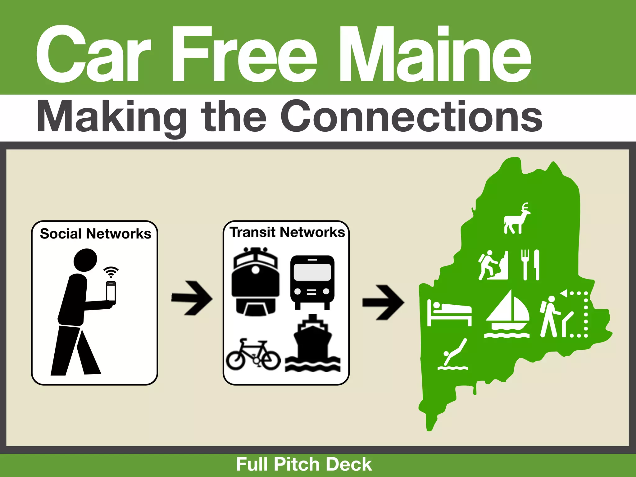
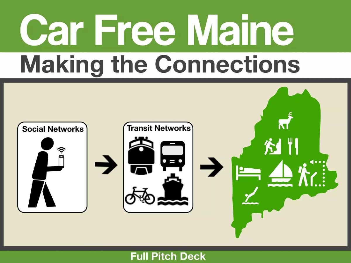
The cover slide introduces the brand 'CarFree Maine' with the tagline 'Making the Connections.' The visual language is utilitarian, using icons for social networks, transit networks (train, bus, bike, ferry), and Maine-based activities (hiking, dining, sailing). It establishes a clear geographic focus on the state of Maine and a functional focus on the 'connections' between users and transit modes.
Slide 2: The Boston Market Opportunity
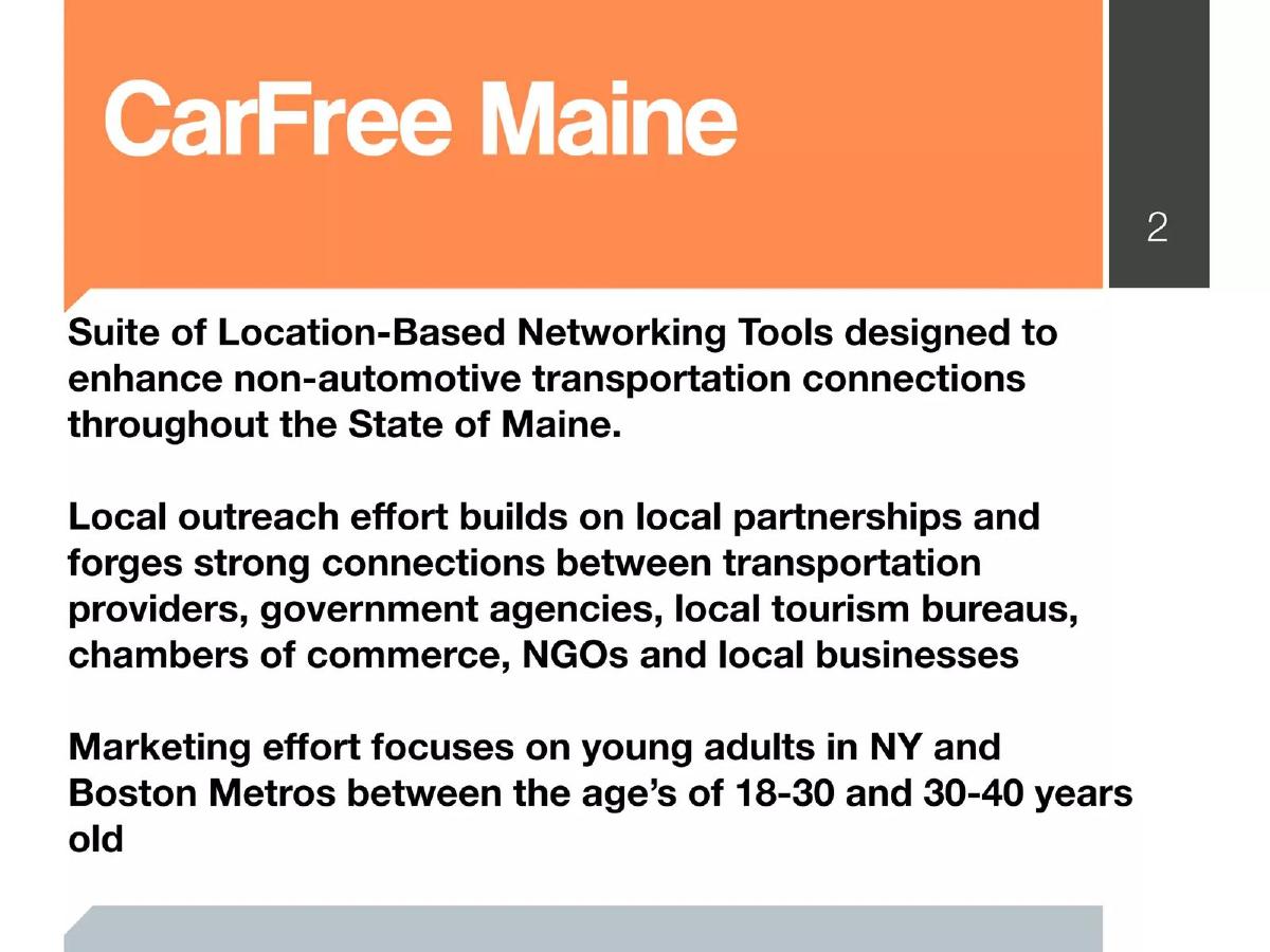
This slide provides the quantitative foundation for the project. It notes that in the City of Boston, almost 92,000 people do not own a vehicle . It further states that 300,000 people commute via public transportation region-wide. Crucially for a tech-enabled solution, the slide claims that 1/3 of users (100,000) use Mobile Transit Apps . The demographic breakdown shows that 58% of transit users are between 25 and 44 years old, suggesting a prime market for a mobile-first travel platform. The data is attributed to the 2005-2009 American Community Survey.
Slide 7: The Rail Infrastructure
Slide 7 highlights the existing transit link: the Amtrak Downeaster. It states that nearly 500,000 people a year ride the train between Boston and Portland, Maine. It also notes a scheduled extension to Freeport and Brunswick for the Fall of 2012. This slide serves to prove that the 'middle mile' of the journey is already high-capacity and well-utilized, leaving the 'last mile' and destination discovery as the primary problems to be solved.
Slide 10: The Proposed Solution
The solution is presented as a two-step process: research and planning on the CarFree Maine web page, followed by finding local transit connections via a GPS-enabled mobile app . The graphic illustrates a user moving from a train to a bus, mediated by their smartphone. This positioning suggests the product is a navigation and discovery layer sitting on top of existing physical infrastructure.
Slide 11: Website and App Interface Mockup
This slide shows a browser window mockup for carfreemaine.org . The interface includes tabs for Routes, Local, Map, Connect, Book, Media, and Blog. The 'Express' section features logos for transit providers like COAST, while the 'Local' section includes the Airbnb logo and 'The Maine Art Museum Trail.' A sidebar for the mobile app mentions features like mapping routes, sharing waypoints, and getting group discounts. The 'Connect With' section displays icons for Facebook, Twitter, Google, Yelp, and Foursquare, indicating a heavy reliance on social integration.
Slide 15: The Technical Ecosystem
This is a complex diagram titled 'Social Transportation' and 'Collaborative Mapping.' It lists various data sources and partners, including Waze, iCarpool, OpenStreetMap, and GeoCommons . It categorizes these into 'Mobile,' 'Social Media,' 'Open Source/Commons,' and 'Electronic Data' (specifically GTFS, GIS, and KML formats). This slide demonstrates that the founders view the platform as an aggregator of existing data streams rather than a creator of new proprietary mapping data.
Slide 19: Gamification and Incentives
Titled 'Play,' this slide explains how the platform will encourage user participation. It cites 'Geo-Social' networks like Foursquare and Gowalla , which use badges and mayorships to drive engagement. It also mentions 'Local Deal-a-day' platforms like Groupon and Living Social as models for tandem utilization. This suggests the company intends to use gamification to solve the 'cold start' problem of user-generated content.
Slide 22: Reaching Critical Mass
The final slide in this set addresses the challenge of population density. It defines a 'Critical Mass' threshold of roughly 300 users for the application to be effective. The slide lists 'Lighthouse Customers' (cyclists, urbanists, students) and an 'Expanded User Base' (cultural tourists, retirees, skiers). It acknowledges that reaching this mass in low-density areas is a primary challenge and identifies the need for 'Champions' to contribute the majority of early content.
What CarFree Maine Does Well
The deck excels at identifying a specific, reachable niche. By focusing on the Boston-to-Maine corridor, the founders have narrowed their scope to a manageable geographic area with high existing transit usage. The use of specific statistics regarding car ownership and app usage in Boston (Slide 2) provides a logical 'why now' for the project. Furthermore, the technical slide (Slide 15) shows a sophisticated understanding of the open-source and social data landscape required to build a modern transit app.
What Is Missing from the Deck
The most glaring omission is a Business Model . There is no mention of how CarFree Maine intends to make money—whether through booking commissions, advertising, or data licensing. Additionally, there is no Team Slide , which is critical for investors to evaluate the founders' ability to execute a technically complex aggregation platform. The deck also lacks a Financial Ask or a roadmap for development. As it stands, the deck feels more like a project proposal for a non-profit or a government grant than a venture-backed startup pitch.
Founder's Takeaway: Lessons to Copy
Founders should look at Slide 2 as a model for market sizing through proxy data . Instead of claiming a multi-billion dollar market, the deck uses specific, verifiable census data to prove that a specific type of user (car-free, app-using commuters) exists in a specific location. Another takeaway is the 'Critical Mass' slide (Slide 22) . Acknowledging the difficulty of network effects in low-density areas and setting a specific target (300 users) shows a level of operational realism that is often missing from early-stage decks. Finally, the integration diagram on Slide 15 is a good way to show how a 'lean' startup can leverage existing APIs and open-source data to build a feature-rich product without reinventing the wheel.
Note: This teardown is based on the 8 slides provided from a total of 23. The missing slides may contain the team, financials, and business model omitted here.
Frequently asked questions
- What is the primary problem CarFree Maine is trying to solve?
- The deck addresses the friction between urban dwellers who do not own cars and the difficulty of accessing regional tourism destinations in Maine. It highlights that while hundreds of thousands of people use transit in Boston, connecting those users to Maine's 'last mile' transit and local activities requires a unified digital interface that combines planning, booking, and social discovery.
- Who is the target audience for this platform?
- The platform targets 'Lighthouse Customers' such as cyclists, urbanists, environmentalists, and students. Specifically, it looks at the 100,000 people in the Boston area already using mobile transit apps and the nearly 500,000 annual riders of the Amtrak Downeaster who are already predisposed to regional rail travel.
- How does the company plan to acquire and retain users?
- The strategy involves using 'Geo-Social' incentives, such as badges and mayorships similar to Foursquare, and local deal-a-day offers like those found on Groupon. The deck also emphasizes the importance of 'Champions'—a small percentage of highly engaged users who contribute the majority of content in the early phases to reach a critical mass of 300 users.
- What technical integrations does the deck propose?
- Slide 15 outlines a complex ecosystem of integrations, including collaborative mapping (Google Map Maker, OpenStreetMap), social transportation (Waze, iCarpool), and online mapping formats (GTFS, GIS, KML). The goal is to create a 'Social Transportation' hub that pulls from both open-source commons and proprietary social media data.
- Is there a clear path to revenue in this deck?
- No. The provided slides do not mention a business model, transaction fees, advertising, or subscription tiers. While it mentions 'Book' and 'Local Deals' on the website mockup (Slide 11), there is no explanation of how the company captures value from these interactions or how it plans to sustain operations financially.